Geer Services is a full-service GIS provider and web application development firm, offering a wide variety of consulting services to enhance your organization’s productivity.
Geer GIS Consulting Services’ primary focus is on the successful implementation of web enabled GIS products. With over 18 years of experience working with ESRI® products such as ArcGIS Server, JavaScript API, ArcSDE, and database solutions such as MySQL, SQL Server or Oracle®, our company has the experience and know-how to create enterprise GIS systems or improve the overall performance of your existing system. Other services that complement our GIS offerings include graphic design and web development expertise to enhance your company’s image and generate a professional and productive web presence.
In addition to technical consulting services, Geer Services has the unique ability to apply the GIS and database technical solutions to solve your most critical business problems.
Currently Geer Built® GIS Consulting Service Offerings
- Geographic Information Systems (GIS)
- GIS Data Management
- GIS System Design
- GIS Systems Integration
- GIS Software Selection
- GIS Software Installation & Configuration
- Spatial Database Design
- GISFaces™
- PrimeFaces
 What Is GISFaces™?
GISFaces™ is an Enterprise GIS mapping component for Java Server Faces (JSF). Combined with PrimeFaces, GISFaces allows our team to design and implement GIS enabled enterprise applications for our clients. The underlying GIS mapping engine used by GISFaces is the ESRI® ArcGIS API For JavaScript. Any ArcGIS service layers available, local or online, can be used in the maps you build. All of our example maps are built with publicly available service layers.
Some of our GIS applications and consulting work:
The SERUG 2013 Attendee tool
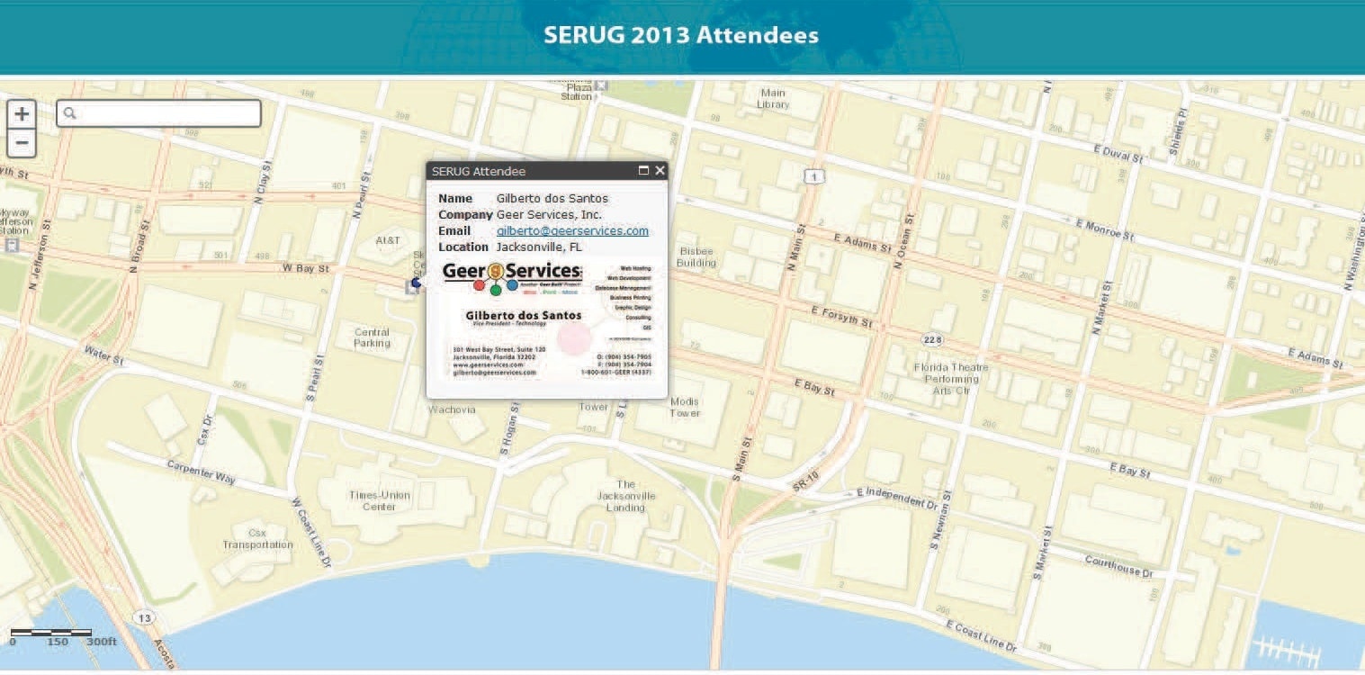
Developed using PHP with a JavaScript API front end. We built this for fun to see who visits our booth during the 2013 ESRI Southeast User Conference in Jacksonville, Florida. There is a PHP administration panel to allow data input and image upload functionality. The original application was used to locate artists who would set up their easels around the city streets of Jacksonville and allow visitors to locate them using the map interface.
The Map Service Explorer
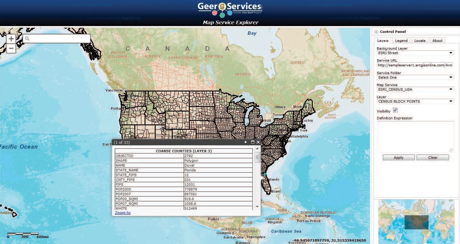
A JavaScript API application to allow GIS technical resources to browse their published web services. The GIS person can select their web service url, set a directory if necessary, and select any map service and associated layer published under that map service. Definition expressions can be applied to filter data as desired. This is an extremely useful tool to browse your services in an efficient manner.
Java Server Faces Container
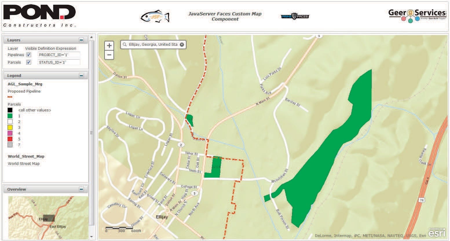
The Java Server Faces Container encapsulates the JavaScript API map interface into JSF component. This allows an efficient method to easily add a map interface to your Java code. Combined with Prime Faces, sophisticated applications can be developed using the components published by Geer Services and Prime Faces. If you are a developer, you have to see the simplicity of the code you can add to your project.
Current Conditions Map
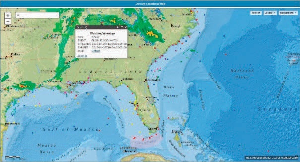
Provides a view of current weather information from NOAA including Doppler radar, weather warnings, advisories, floods, hurricanes, volcanoes, wildfires and other weather related events. We use this in our office to view real time weather conditions to see if we need to run for it or just grab an umbrella. Background layers can be selected as desired and this is a hit for our customers who come in and notice the weather conditions outside the office.